| |
1956 year.
a political map of the World.
Molotov and Sverdlovsk regions of the RSFSR in 1956
|
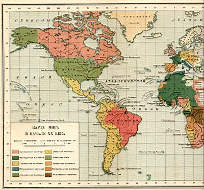
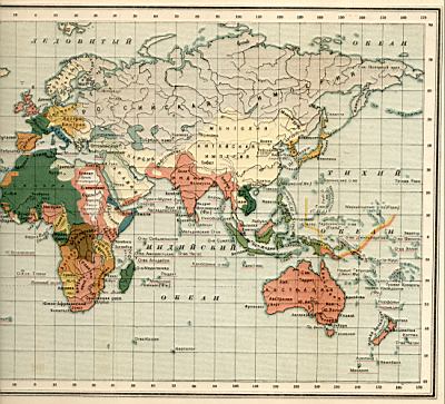
1900 year. Political map of the world in the early 20th century
 |
 |
Political map of the world in the early 20th century. Download a detailed map
 Created to find ...
| |
1956 year.
a political map of the World.
Molotov and Sverdlovsk regions of the RSFSR in 1956
|
| |
|
Political map of the world in the early 20th century. Download a detailed map

It will not be superfluous for your friends to learn this information, share their article with them!
Comments
Commenting on, remember that the content and tone of your message can hurt the feelings of real people, show respect and tolerance to your interlocutors even if you do not share their opinion, your behavior in the conditions of freedom of expression and anonymity provided by the Internet, changes Not only virtual, but also the real world. All comments are hidden from the index, spam is controlled.