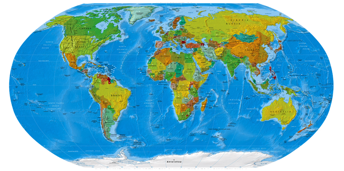
Maps of Asia Perry-Castaneda
Library of Perry-Castaneda maps (over 250,000 maps online)

The Perry-Castaneda map library includes over 250,000 online maps.
Library of the University of Texas.
Asia Maps
- Asia (Political) 2012 (3.6MB) [pdf format]
- Asia (Reference Map) 2012 (747.5K) [pdf format]
- Southeast Asia (Reference Map) 2012 (441.2K) [pdf format]
- Asia Historical Maps
A, B, C, D, E, F, G, H, I, J, K, L, M, N, O, P, Q, R, S, T, U, V, W, X, Y, Z
- Afghanistan Maps
- Armenia Maps
- Asia (Political) 2012 (3.6MB) [pdf format]
- Asia (Political) 2008 (972KB)
- Asia (Political) 2000 (278)
- Asia (Political) 1997 (425K)
- Asia (Political) 1997 (1.7MB) [pdf format]
- Asia (Political) 1992 (326K)
- Asia (Reference Map) 2012 (747.5K) [pdf format]
- Asia (Reference Map) 2010 (697K) [pdf format]
- Asia (Reference Map) 2007 (920K) and pdf format (514K)
- Asia (Reference Map) 2004 (419K) and pdf format (423K)
- Asia (Reference Map) 2003 (387K) and pdf format (390K)
- Asia (Reference Map) 2002 (333K) and pdf format (333K)
- Asia (Reference Map) 2001 (1.1MB) [pdf format]
- Asia (Reference Map) 2000 (230K) and pdf format (866K)
- Asia (Reference Map) 1999 (230K) and pdf format (652K) and larger jpeg (336K)
- Asia - Aeronautical Charts - Joint Operations Graphic Series 1: 250,000 [Not for navigational use]
- Asia - Aeronautical Charts - Operational Navigation Chart Series 1: 1,000,000 [Not for navigational use]
- Asia - Aeronautical Charts - Tactical Pilotage Chart Series 1: 500,000 [Not for navigational use]
- Asia - Topographic Maps - International Map of the World 1: 1,000,000
- Azerbaijan Maps
- Bahrain Maps
- Bangladesh Maps
- Bhutan Maps
- Brunei (Political) 1984 (319K)
- Brunei (Small Map) 2014 (18K)
- Burma Maps
- Cambodia Maps
- Caspian Region Oil Pipelines (633K) April 2002 [pdf format]
- [Caspian Region] Oil and Gas Infrastructure in the Caspian Sea Region 2012 (6.9MB)
- [Caspian Region] Oil and Gas Infrastructure in the Caspian Sea Region 2001 (2.5 MB)
- Caspian Region North (497K) Caspian Region South (359K) Map Legend (138K)
- Caucasus and Central Asia (Political) 2009 (846K)
- Caucasus and Central Asia (Political) 2003 (255K) and pdf format (258K)
- Caucasus and Central Asia (Political) 2000 (171K) and pdf format (186K)
- Caucasus and Central Asia (Political) 1995 (231K)
- Caucasus and Central Asia (Political) 1993 (223K)
- Central Asia (Major Ethnic Groups) 1993 (694K)
- China Maps
- Commonwealth of Independent States Maps
- Commonwealth of Independent States - Central Asian States (Political) 1995 (242K)
- Commonwealth of Independent States - Central Asian States (Political) 2002 (190K)
- Commonwealth of Independent States - Central Asian States (Reference Map) 2002 (190K) and pdf format (209K)
- East Asia (Political) 2011 (499K)
- East Asia (Political) 2004 (500K)
- East Asia (Political) 1995 (221K)
- East Asia and Oceania (Political) 1992 (225K)
- East Timor Maps
- Eurasia (Political) 2006 (4.5MB)
- Gaza and West Bank Maps
- Georgia Maps
- Hong Kong Maps
- India Maps
- Indian Ocean Maps
- Indochina (Shaded Relief) 1985 (342K)
- Indochina and Thailand, Series L506 (Topographic Maps) 1: 250,000, US Army Map Service, 1954-
- Indochina Atlas 1970
- Indochina Ethnolinguistic Groups From Indochina Atlas, 1970 (654K)
- Indonesia Maps
- Iran Maps
- Iraq Maps
- Israel Maps
- Japan Maps
- Jordan Maps
- Kashmir Maps
- Kazakhstan Maps
- Korea Maps
- Kuwait Maps
- Kyrgyzstan Maps
- Laos Maps
- Lebanon Maps
- Macau Maps
- Malaysia Maps
- Middle East Maps
- Mongolia Maps
- Myanmar Maps
- Nepal Maps
- Oman Maps
- Pakistan Maps
- Paracel Islands (Small Map) 2014 (16K)
- Paracel and Spratly Islands 1988 (229K)
- Philippines Maps
- Qatar Maps
- Russia and Former Soviet Republics Maps Includes the Asian Republics
- Saudi Arabia
- Sikkim (Shaded Relief) 1981 (302K)
- Singapore Maps
- South China Sea (Islands) 1988 (229K)
- Southeast Asia (Political) 2012 (2.0MB) [pdf format]
- Southeast Asia (Political) 2003 (290K) and pdf format (293K)
- Southeast Asia (Political) 1997 (323K)
- Southeast Asia (Political) 1995 (214K)
- Southeast Asia (Political) 1992 (216K)
- Southeast Asia (Political) 1997 (1.2MB) [pdf format]
- Southeast Asia (Reference Map) 2012 (441.2K) [pdf format]
- Southeast Asia (Reference Map) 2009 (1MB) [pdf format]
- Southeast Asia (Reference Map) 2007 (788K) and pdf format (349K)
- Southeast Asia (Reference Map) 2002 (299K) and pdf format (270K)
- Southeast Asia (Reference Map) 2000 (257K)
- Southeast Asia (Reference Map) 1999 (258K) Larger JPEG Image (493K)
- Southeast Asia (Reference Map) 2001 (748K) [pdf format]
- Southeast Asia (Reference Map) 2000 (645K) [pdf format]
- Southeast Asia (Reference Map) 1999 (163K) [pdf format]
- Southwest Asia (Political) 2009 (696K)
- Southwest Asia (Political) 2000 (222K)
- Southwest Asia (Political) 1996 (243K)
- Southern Asia (Political) 2004 (534K)
- Southern Asia (Political) 1994 (485K)
- Spratly Islands (Political) 1995 (218K) and pdf format (221K)
- Spratly Islands 1988 (223K)
- Spratly Islands (Small Map) 2014 (21K)
- Sri Lanka Maps
- Syria Maps
- Taiwan Maps
- Tajikistan Maps
- Thailand Maps
- Topographic Maps of Asia
- Turkey Maps
- Turkmenistan Maps
- United Arab Emirates Maps
- Uzbekistan Maps
- Vietnam Maps
- West Bank and Gaza Maps
- Yemen Maps


Comments
Commenting on, remember that the content and tone of your message can hurt the feelings of real people, show respect and tolerance to your interlocutors even if you do not share their opinion, your behavior in the conditions of freedom of expression and anonymity provided by the Internet, changes Not only virtual, but also the real world. All comments are hidden from the index, spam is controlled.