Unknown water reservoirs of Ukraine: 14 waterfalls, lakes, canyons and bays

Traveling, there is always a desire to find places undefiled by the presence of civilization, where the human foot has not set foot.
But often all the rest is repeated at the same popular resorts in Turkey, Egypt and other countries, where it is always crowded, and in especially "good" time - do not push through.
Ukraine can boast of hidden corners, remote from other people's eyes, so the search for an alternative is wide and varied.
In our review: Buk Canyon, White Lake, Sholokhov (Tokovskiy) Cascade Falls, Aktov Canyon, Arbuzinsky Canyon, Kobalar Waterfall (Kozyrek), Blue Lakes in Shchurovo, Silver Waterfall, Bakotsky Bay, Canyon of the Sinyuha River, Soledar Lake, Dzhurinsky (Chervonogradsky ) Waterfall, Lake Cahul, Kok-Asan Canyon.
Buk Canyon
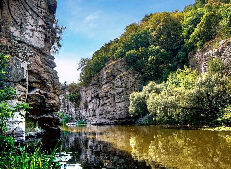
Buk canyon is rightfully called one of the most beautiful places in Central Ukraine. Its stone banks, whose age is estimated at 2 billion years, hang over the rapid river Gorny Tikich. This place has long been chosen by climbers. The winding and long Buk canyon begins near the two-meter cascade of the former hydroelectric dam, popularly known as the Vod waterfall. Here you can also see the picturesque ruins left by the old water mill, which was built in the 19th century. You can admire the surroundings of the canyon at the very edge of the water, having a picnic or staying here with a tent for the night.
On the border of the two regions of Vinnytsia and Cherkassy, not far from the village of Buki, is one of the most beautiful canyons in Ukraine. Despite its small length - just over 5 kilometers, it attracts many tourists. Someone comes to admire the rocky banks of the Buk canyon, while others arrange picnics on numerous glades on either side of the river.
The canyon is formed by the river Gorny Tikic and ancient rocks. At the very beginning of the canyon, the two-meter high waterfall Vyr, which is the remains of the first Ukrainian hydroelectric power station, is noisy. There was also a water mill built in the 19th century, and its ruins can still be seen today.
The depth of the canyon reaches 20 meters, while the width - no more than 40 meters. The surrounding magnificence is very little like the landscapes of Ukraine and reminds Switzerland. The canyon is popular among mountain climbers, although the rocks are not very high, but they are steep and perfectly suitable for training.
Where is: near the village of Buki, Mankovsky District, Cherkasy Region.
White lake
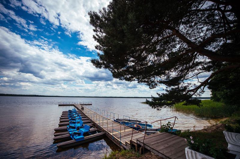
Lake of karst origin with clear and transparent water. The bottom is mostly sandy. From a bird's-eye view, it seems that this pond is a real white color. White Lake has medicinal properties, it is also called the "lake of youth". All this is due to the high content of glycerin, the water here is even soft to the touch.
The White Lake is located near the village of Rudka in the Volodymyrtec district of the Rivne region. The lake has the glory of a healing and unique pond. It is the center of the hydrological complex that combines forest and marsh massifs. Its bicarbonate-calcium-magnesium water with an increased content of glycerin is considered curative. And the picturesque landscapes around do not leave indifferent any traveler.
The well-known scientist Pavel Tutkovsky assures that during the Dnipro glaciation, which is the largest in the history of the Earth, the area where the White Lake is now located was the site of the glacier. That is why there is such a rich relief here with the only mounds in the Rivne region. According to the scientist, only here you can see unique plants of glacial relics. Located at 156.5 meters above sea level, the lake has an oval shape and ten meters of depth. The water in the lake is very clean, and its transparency reaches 2.5 meters. Here you can see beavers, muskrats. And on the shore you can find unique plants, among which there is Molodonfilnik lake, listed in the Red Book. Finally, this is the only lake in Ukraine with a high content of glycerin in water, which makes it salubrious. It is said that even during Poland a narrow-gauge railroad was built to carry miracle water to Warsaw to treat the wife of the head of the Polish state, Mrs. Pilsudskaya. Unusual water, which healed wounds, is mentioned in the UPA guerrilla archives.
They say that once there was a village here. But its inhabitants did not know how to have fun and enjoy life, did not go to church, did not believe in light feelings. Only a poor guy and a girl from a wealthy family secretly met in the clearing, which is now called the local "Island of Love." Once an angel descended to the people and warned them of the danger that awaits them in case of disobedience to God, but the peasants did not believe. And then one day the village disappeared under a powerful wave of water. And the two lovers turned into white swans, who are still returning to their island in spring, reminding people of the earthly joys of life. A romantic legend beckons to the shores of the healing lake and tourists. You can get to this place both from Rivne and Lutsk on a fixed-route taxi.
Where is located: Rudka village, Vladimiretsky district, Rivne region.
Sholokhov (Tokovskiy) cascading waterfall
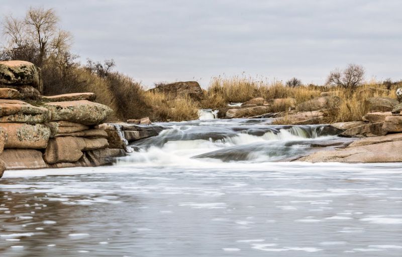
Sholokhov waterfall in the people is known under the name "Red Stones". This name was given to the terrain because of the red granites characteristic of this landscape. It is noteworthy that this granite can be found throughout the Dnipropetrovsk region, they are found in architectural elements or monumental buildings. In itself, the Sholokhov waterfall is small, its length is about 14 m with swings from a few centimeters to several meters. The waterfall starts from the tributary of the Bazavluk River. This cascading waterfall arose in the Mesozoic era. Imagine, he was a witness of the birth of human civilization.
The cascading waterfall, known as the "Red Stones", is one of the most beautiful places in the Dnipropetrovsk region. Oasis, stretched among the picturesque hills, attracts many tourists every year.
Enjoying the contemplation of the noisy waterfall, whose length is about 14 meters, is best in spring, when the turbulent streams are particularly deep. The waterfall consists not only of cascades, whose height reaches one and a half meters, but also rapids, and granite "baths", which is its highlight. Not far from the waterfall is a picturesque lake.
In Soviet times, the waterfall was almost destroyed. Its name - "Red Stones", he received because the granite rocks, among which the waterfall flows, have a characteristic reddish tinge. Earlier in these places there was a stone crushing plant, it is possible to find traces of development to this day. The granite extracted here was used to build many buildings. For example, they were facing Moscow's bridges and metro stations. Due to the subversive work that was conducted during the extraction of the stone, the waterfall suffered. And the rare plants that grew in this area have disappeared. This hydrological nature monument is located 55 km from Nikopol and 100 km from Dnepropetrovsk.
Where is located: Tokovskoe village, Apostolovsky district, Dnepropetrovsk region.
Aktov Canyon
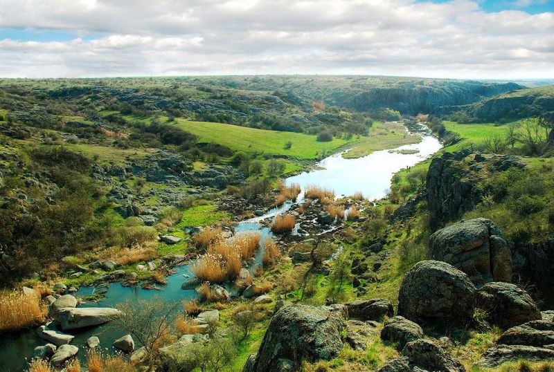
Aktov Canyon is a unique place where the ensemble of sheer rocks and granite boulders is combined with the world of plants. It is called "Canyon of the Devil" or "Small Crimea". With its landscape, this area resembles the famous canyons of North America. The flowing river Deadwater is saturated with hydrogen sulphide and has a strange color, but there are places for swimming with clear clear water. Next to the Aktov canyon is another amazing place - Trikratskiy forest-labyrinth.
A piece of North America with its world-famous canyons you can see in the Mykolaiv region. Granite boulders, sheer cliffs, huge stone blocks, hanging over the river Deadwood, were called the "Valley of the Devil."
Aktov Canyon, which is part of the National Nature Park "Bugsky Gard", is included in the list of seven natural wonders of Ukraine and is considered one of the oldest Eurasian land sites. The depth of the Ukrainian canyon reaches 50 meters, and the area occupied by it is 250 hectares.
Because of the difficult terrain of the terrain, tourists can not raft on the river Deadwood, but here the local places are loved by climbers. The valley is of interest for fans of antiquity and those who are fond of esotericism. After all, the canyon was the sacred center of Scythia, where in ancient times people performed rituals and offered prayers to their gods.
Where is: with. Aktau, Voznesensky district, Mykolayiv region.
Arbuzin Canyon
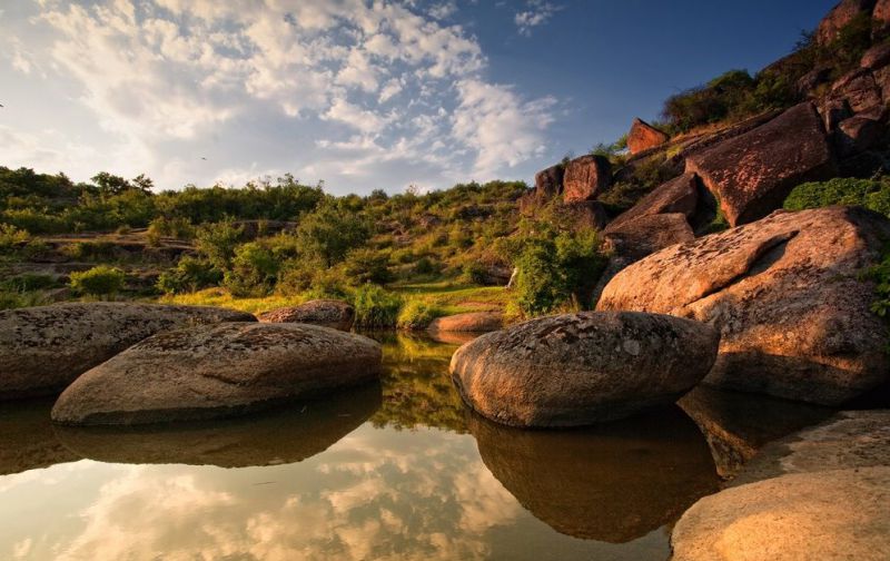
The Arbuzin Canyon is the younger brother of the Aktov Canyon. The name he gave a small but persistently piercing his way through the boulders river Arbuzinka. According to calculations, granite-basalt rocks of the Arbuzinsky canyon formed about 4 billion years ago. Due to its volcanic origin, there is no winter in this region, because the volcano that gave birth to this region has not cooled down yet. Both canyons - Aktovsky and Arbuzinsky - are part of the natural park "Bugsky garde".
The Arbuzinsky Canyon is located near the villages of Aktovo and Trikraty and is part of the National Nature Park "Bugsky Gard". Arbuzinsky canyon is located near the Aktov canyon, therefore it is often called the Small Aktov Canyon.
The rock of Arbuzin canyon was formed more than 4 billion years ago due to volcanic activity, which in ancient times operated almost on the entire surface of the Earth. The rocks that stand hundreds of years, surprisingly have minimal destruction. During the centuries, the Southern Bug River and many adjacent rivers pierced their way through the stones gradually forming stony gorges with the river below. So Arbuzinsky canyon was formed. Local residents argue that the volcano, which formed this miracle of nature, has not cooled down - almost always in the midst of winter violets bloom. Arbuzinsky canyon is truly beautiful: the rocks washed by water for centuries, became smooth and overgrown with green moss; Every corner is overgrown with all sorts of trees and flowers. On the territory of the canyon live such animals as: moles, bison, muskrats, wild boars, deer. By the way, stones were installed in Vienna, which symbolized all continents, and the stone of Europe was taken from this place.
Of course, after learning about such an amazing place, there is a desire to immediately get there. However, the path to the canyon is not easy. It is best to go here by car. To the Arbuzinsky canyon you can get either on the road through the village of Berezovka, or through the city of Nikolaev. Through Berezovka you can get to the canyon faster, but it's better to go through Nikolayev - the road will be a little longer, but it will be even and lighter.
Where is: near the villages of Aktovo and Trikraty, Voznesensky district, Mykolaiv region.
Waterfall Kobalar (Kozyrek)
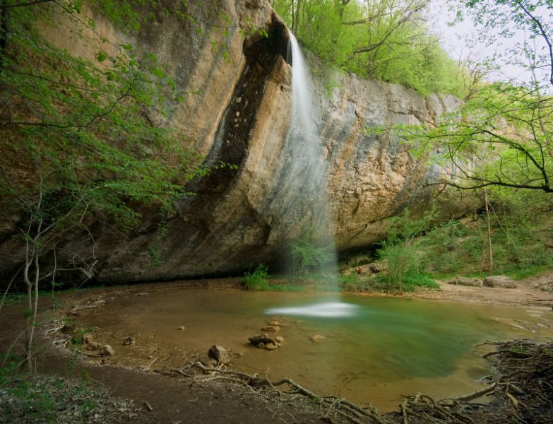
Among waterfalls, there are so-called ephemeral waterfalls - those that appear only in wet weather. Kobalar is just like that. From a height of 14 m the stream falls into a small lake, creating a transparent water curtain. You can admire this spectacle only in the spring and winter, in the summer time of the year the source, as a rule, runs dry. The name of the peak was given to this place due to the unusual shape of the ledge, from which a small stream falls.
On the creek of Kobalar-Su three kilometers from the village of Peredovoe is located one of the most beautiful waterfalls of the peninsula of Crimea - the Kobalar waterfall. On the way to the Baidar valley, the stream flows along the valley of Kobalar Dere, which is surrounded on all sides by mountains, hiding the most picturesque places in its cottages. From a height of about 14 meters the stream falls into a crystal clear lake, forming a screen of water under the rocks. Because of the peculiar projection of the waterfall, from which water falls, the tourists gave this beautiful place its simple name - Kozyrek. In translation from the Turkic language "Kobalar" means "cave ravine".
A magnificent stream can be admired only in the winter and spring periods. Unfortunately, with the onset of summer, the waterfall together with the stream usually dry out. After all, the waterfall "lives" due to meltwater, which descend from the snow-capped peaks. From time immemorial and almost until the 18th century, in the vicinity of the waterfall, many snails could be found, which at various times were practically food of local residents. Soon the markets of cities such as Yalta, Balaklava and Sevastopol were filled with these shellfish. During the Great Patriotic War, snails were cooked on the waterfall from snails, and by that whole families were saved from starvation. From Kozyrka you can walk to several more beautiful waterfalls, which are located upstream on the tributaries of the creek.
A hiking trail leads to the waterfall, and in its surroundings there are places for rest, in which you can not only enjoy a magnificent view, but also have a shish kebab.
Where is located: the village of Peredovoe, Sevastopol district, Crimea.
Blue Lakes in Shurovo
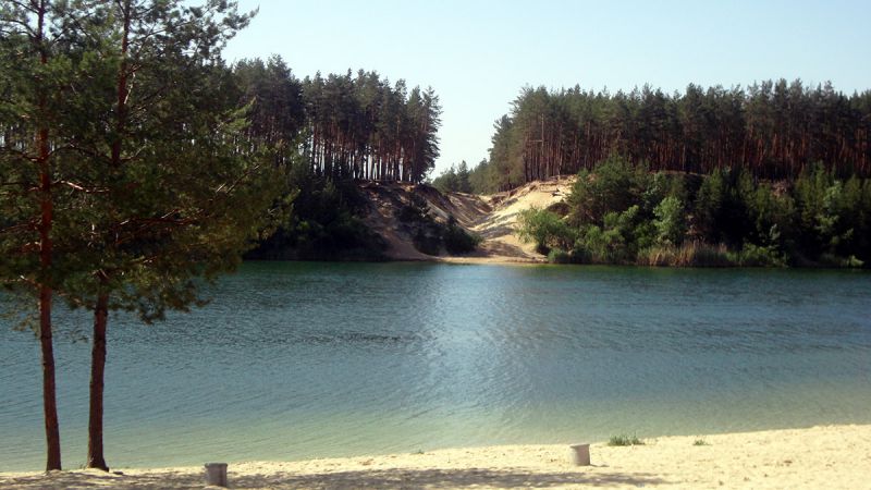
The name " Blue Lakes " speaks for itself. The water in them is really clean, blue and never stagnates. This is due to underground sources, which ensure a constant circulation of the water flow. The area is surrounded by pine forest and sandy beaches.
This amazing landmark is located near the village of Shurovo in the Donetsk region. It's amazing because it has crystal clear water. A few years ago here were located careers. In the 1960s, careers were filled with water from the spring, and the Blue Lakes began to exist. On the lakes there was one more active pit, with the help of which sand is extracted.
Many tourists dream to visit this place, breathe clean air, plunge into the world of nature. It's very beautiful here, it seems that the person's hand did not touch this beautiful place at all. Pine forest surrounds the Blue Lakes, so the air here is just as clean as the ponds themselves. The tourists who arrived for the first time to the Blue Lakes are pleasantly impressed, as the water is really blue, even after a long time it does not stagnate. Sandy beaches are always clean.
This is a great place for a family holiday. Having been here, you will gain energy and strength, and also you can admire the amazing nature.
Where is located: the village of Shchurovo, Krasnolimansky district, Donetsk region.
Silver Waterfall
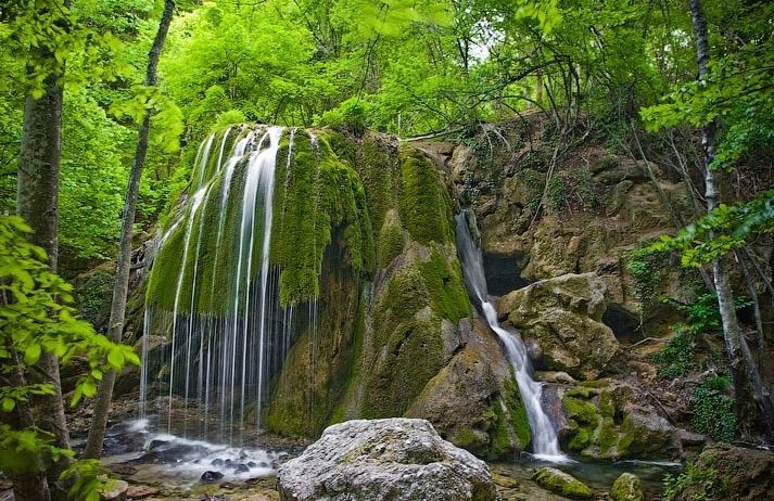
This Crimean landmark is unusually beautiful at any time of the year. Waterfall Silver streams or just Silver represents an overhanging moss cap, over which silver threads of water flow. Look at it carefully in the sunlight.
This incredible beauty falls in the Crimea near the village of Falcon. Waterfall Silver streams can not leave anyone indifferent, look at this natural wonder come foreign tourists.
The appearance of the waterfall is like a huge musical instrument, and running water, like silver strings. Looking at him, there is an impression that someone really is playing on him, and his melody is audible to all the inhabitants of the forest. At the top is a huge green moss cap. This gives the Silver Waterfall some originality. You will be lucky if you find this enchanting attraction after heavy rains or filled with thawing snow. Then the descending water causes delight.
The waterfall is especially beautiful both on hot days and frosty, so at any time of the year it is an impressive sight to look at. The silver waterfall is located next to a beautiful forest that blows with clean and pleasant air. This place causes only positive emotions and impressions, so it's worth a visit.
Where is: near the village of Sokolinoye, Bakhchsarai district, Crimea.
The Bay of Bashkortostan
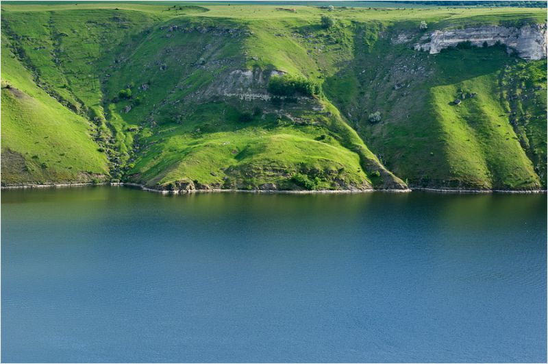
The emergence of the Bakotsky Gulf is associated with the flooding of four villages in the Dniester Valley after the completion of the construction of the Novodnestrovskaya HPP. Now, coming here, you can admire truly cosmic landscapes. The uniqueness of this place lies in the fact that it is surrounded by rocks, so there was formed a special microclimate, characteristic for the southern latitudes. An inexperienced traveler will always find something to do in this wonderful land.
Bakotsky Bay is located 50 km from the city of Kamenets-Podolsky. He is not inferior to the landscapes of Crimea or Croatia. Earlier on this place stood the village of Bakota, but the construction of the Dniester hydroelectric power station had negative consequences and the whole village went under water. In this unique place, you will discover amazing pictures of nature, you will be fascinated by the locality of the Bakotsky Gulf. There is a fairly warm climate because of the rocks present, which withstand all the gusts of the wind and create a quiet weather, which is especially popular with tourists.
Kievan Rus left here its memo - a rock monastery. Visiting tourists can not resist, and first of all they hasten to get to St. Michael's Monastery, which is located inside the rock. Near the monastery there are springs with mineral waters. They say that they have healing properties and are able to positively influence human health.
It is best to stay in Kamenets-Podolsky, there is a large selection of housing for any wallet. At the very gulf you can stay in tents, there is also an opportunity to rent a trailer. Food should be taken with you, although on the territory often open a small tent where you can buy something to eat. The nearest store is two kilometers away. Often tourists come here for one day. Here you can swim a lot. There is a wooden pier, a catamaran and several boats. For the evening, it's better to take warm clothes and mosquito repellent. This paradise corner will allow you to plunge into the world of pure, beautiful nature, get a lot of positive emotions, forget all everyday problems and completely relax.
Where is located: Bakot, Kamenets-Podolsky district, Khmelnytsky region.
Canyon of the Sinyuha River
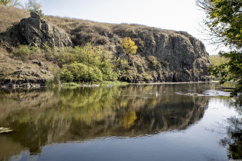
Another little-known place in Ukraine is the canyon of the Sinyuha River . It should be said that the total length of the Sinyuha River is more than 100 km, it is considered to be one of the cleanest rivers, because you will not find any industrial enterprise on it. The canyon itself occupies only a small part of the reservoir, but this site is one of the most beautiful.
The picturesque place, formed by granite rocks that came to the surface, is located on the territory near the village of Ternovka in the mouth of the Sinyuha River, the tributaries of the Southern Bug. Cyanuja flows more than 100 kilometers, but only in this place creates a surprisingly beautiful view. The landscape in this area is represented by a rare deciduous forest, which mainly occupies the banks practically at the very edge of the water. Above the river stands a granite rock, rising above the water at a 20-meter height.
The river Sinyuha is considered one of the cleanest rivers on the territory of Ukraine. This is all due to the excellent indicators of the biosphere and the absence of significant sinks. From the canyon, upstream of the river, there is a hydroelectric power station. If you have the time, you can walk to it. In the canyon there is another local landmark - the building of an old water mill built in these places in the 19th century. Be sure to visit this place. Here you can make great pictures. In addition, only at this point you can cross the river. On the site of the confluence of the rivers Sinyuha and its tributaries Yatran the landscape reserve "Kogutovka" was organized. To get there, you need to go from the mill to the Yatran tributary. There you will see granite rocks of different heights: charming landscapes. There is an ecological path here.
It is necessary to use the route Kiev-Odessa, turn around the city of Uman. From the road the village of Ternovka is 50 km away. It is better to use personal transport or as part of an organized excursion.
Where is: near the village of Ternovka, Novoarkhangelsky district, Kirovograd region.
Soledar Lake
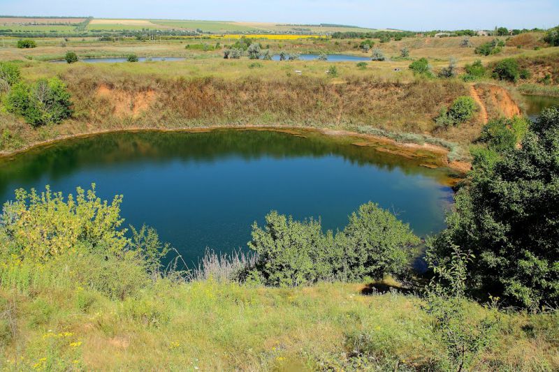
The next reservoir is quite unusual and even mysterious. Soledarskoye Lake has an abnormal water temperature, it is also called a "heated" lake. The fact is that, while descending to a depth, the temperature rises, although it should be exactly the opposite. The catch is that it is not possible to investigate this mystery of nature. In attempts to descend to the bottom, scuba divers noticed that the water becomes denser, turning into a "liquid glass" and pushing to the surface anyone who tries to go too deep.
A small lake near Soledar city of Donetsk region was formed due to mineralized mine waters. Earlier in the lake area, salt was extracted, but then the mines were closed, this happened in the middle of the 20th century. The lakes were discovered by divers in 2011. Also, the surrounding lakes were surveyed, but none of them has similar properties.
Soledar Lake could remain unexplored, but its unique properties were accidentally discovered by local divers, who established that the deeper they descend to the bottom of the lake, the higher the temperature of its water rises. On the surface, water usually does not warm up more than 20-25 ° C, but at a depth of 4-6 meters the temperature rises to 30-40 ° C. This unusual phenomenon raises many questions about the nature of this phenomenon, because the presence of a geothermal outlet in this place is impossible, there remains the assumption of unique undercurrents and water density in the lake at depths of 6 meters, and the liquid consistency rapidly changes to a state that divers describe as "liquid glass". The depth of the lake reaches 100 meters, but its study is seriously hampered due to the unique properties of the water and the strange temperature anomaly.
Diving unprofessional divers in the waters of the lake without the accompaniment of local instructors is undesirable because of the danger that the unique nature of water conceals, which can be compared with the waters of the Dead Sea.
Where is located: Soledar, Donetsk region
Dzhurinsky (Chervonogradsky) waterfall
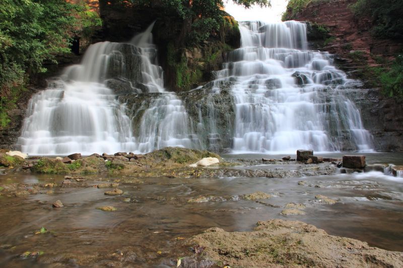
Dzhurinsky Falls - the largest plain waterfall in Ukraine. They say that it originated artificially. The legend says that during one of the Turkish raids, which happened more than 4 centuries ago, the invaders changed the riverbed of the river Dzhurin. The enemy army hoped that the inhabitants of the city would be thirsty and they would remove the defenses of the fortress. By the way, not far from the waterfall are the beautiful ruins of the Chervonohrad Castle. The city with this name has not existed for a long time, but you can look at its remains.
The Djurinsky waterfall is one of the most famous waterfalls in Western Ukraine. By its name, the handsome water owes the same name to the river Dzhurin.
Local residents like to tell an old legend about how during the raids of enemy troops of the Turks, the townspeople hid in the walls of a medieval fortress. Water in it came from the river Dzhurin. The enemy, knowing about this, cunningly redirected the current so that the impregnable stronghold remained without a vital source. A consequence of this was a delightful waterfall, the cascades of which reach a height of several meters. Today the length of the Djurinsky waterfall is 16 meters. The pressure of the water is so great that it is difficult to hear other sounds near the falling water. An excellent addition to the flowing waterfall is a beautiful forest landscape.
In addition to the miracle of nature, travelers should also see the creation of human hands - the nearby castle of Chervonograd. More precisely, these are the ruins of the castle-fortress, which survived from the ancient city. After the Second World War, the city disappeared from the face of the earth, there were only two abandoned towers that keep the memory of the historical events of the 12-13 centuries.
Where is located: Nyrkov village, Zaleschitsky district, Ternopil region.
Lake Cahul
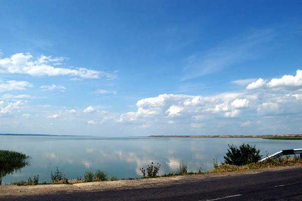
Cahul is a Ukrainian lake that you can not admire. In addition, this is the southernmost point after the Crimea. It is here that birds fly to wait for the winter, their numerous nests can be seen among the rocks. The area around the lake is quite typical for the south. It's hot here and there are no people nearby. In other words - an ideal place to take a breath from the hectic megacities.
The lake is located near the village of Nagornoe, Odessa region. Part of the lake is located on the territory of Moldova. A picturesque view and warm water with wild beaches attract tourists from all around. The maximum depth of the lake reaches 30 meters, the bottom is muddy, closer to the shore, passing into the sand. Not far from the pond is a canyon, crossing a small hill, which offers a wonderful view of the surrounding nature. Basically, Lake Cahul enjoys attention in the hot summer months, at another time of year on its shores you can meet fishermen from among the local residents. It is home to catfish, pike, bream, carp, white cupid and other species of fish. This is the nesting place for many birds. In the limestone rocks you can see their nests.
There are several places for swimming, but it's better to ask local residents about them - so will save time in search of a suitable parking lot. The infrastructure is very poorly developed. If you want to come here with an overnight stay, you should take tents and non-perishable food. In the village of Nagornoe there are shops, but it is still necessary to get there.
With small children, you should not go here, because there are rocks, cliffs, and water is opaque. But the rest here is still beautiful. What's the point of sunset on Lake Cahul?
Where is: near the village of Nagornoe, Reni district, Odessa region.
Kok-Asan Canyon
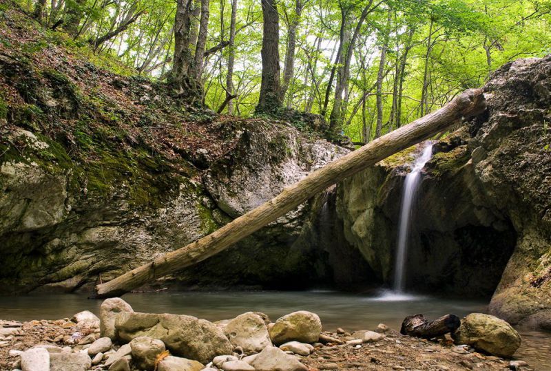
Kok-Asan Canyon is the most untrodden, waterfall and cascading landmark of the Eastern Crimea. It is formed by the river Kuchuk-Karasu, in its possession there are 4 impressive waterfalls with many cascading rapids - the famous Cheremisovsky waterfalls. The highest of them is called Russian slides, where water flows down the rocky massif with zigzags. Do not forget about the "baths of youth" - small lakes with clean and cool water.
The young canyon, which is not even 10 thousand years old, was formed by the Malaya Chernaya River, formerly known as Kuchuk-Karasu. Numerous small and large waterfalls flow from the rocky mountains and hills, which are the outlet of basalt to the surface.
The area around was overgrown with a thick deciduous forest, partially hiding it from the observer. The terrain in this area can be difficult for an inexperienced tourist, so you need to follow the signs or ask for directions from local residents.
The opening view of the canyon and waterfalls makes it possible to feel harmony with nature. Going down or going upstream, you can see not only the waterfalls, the largest of which is located at a 20-meter height, but also small flowing lakes formed by rocky protrusions. The lakes here are shallow enough, so the temperature in them rarely rises above 8-10 ° C even on the hottest day.
Where is located: Povorotnoye village, Belogorsky district, Crimea.
By igotoworld.com


Comments
When commenting on, remember that the content and tone of your message can hurt the feelings of real people, show respect and tolerance to your interlocutors even if you do not share their opinion, your behavior in the conditions of freedom of expression and anonymity provided by the Internet, changes Not only virtual, but also the real world. All comments are hidden from the index, spam is controlled.