
| |
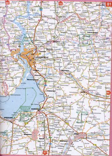
A map of the Zaporozhye (until 1921 the city was called Alexandrovsk).
Main roads, scale 1cm: 750m
|
Map of the Zaporozhye region of Ukraine. Map of highways Zaporizhzhia region Ukraine
Map of the Zaporozhye region of Ukraine. Map of highways Zaporizhzhia region Ukraine
 |
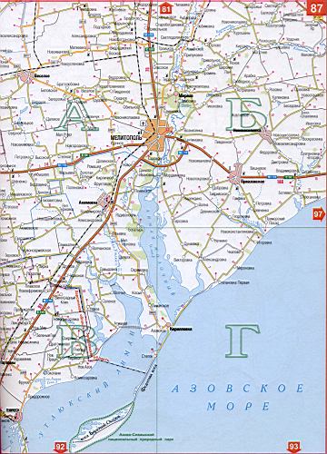 |
Map of Zaporozhye region of Ukraine (regional center of Zaporozhye) Download free detailed map
| Territory | Population | Total areas | Total cities | Total number of villages |
|---|---|---|---|---|
| 27,2 thousand sq. Km | 1861000 | 20 | 14 | 918 |

Comments
When commenting on, remember that the content and tone of your message can hurt the feelings of real people, show respect and tolerance to your interlocutors even if you do not share their opinion, your behavior in the conditions of freedom of expression and anonymity provided by the Internet, changes Not only virtual, but also the real world. All comments are hidden from the index, spam is controlled.