
| |
Map of Ivano-Frankivsk, detailed plan of the city of Ivano Frankivsk scale 1cm-150meters
|
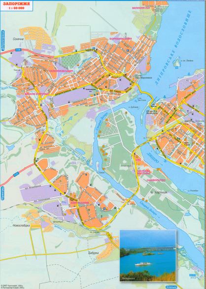
Map of Zaporozhye new 2008y. Roads, the scheme of transit through the city of Zaporozhye
 |
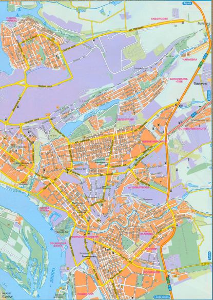 |
Map of Zaporozhye new 2008y. Roads, the scheme of transit through the city of Zaporozhye

Comments
When commenting on, remember that the content and tone of your message can hurt the feelings of real people, show respect and tolerance to your interlocutors even if you do not share their opinion, your behavior in the conditions of freedom of expression and anonymity provided by the Internet, changes Not only virtual, but also the real world. All comments are hidden from the index, spam is controlled.